Carbon Management Canada partners with STRYDE and Explor to demonstrate how new seismic technology can mitigate current CCUS development challenges and enable ongoing monitoring via high-density seismic acquisition
Calgary, 2 June 2021 – Pioneering seismic technology provider STRYDE today announced its Nodes were used in conjunction with Explor PinPoint technology to achieve a new global record in land seismic trace density at the Carbon Management Canada (CMC) Field Research Station. STRYDE, Explor, and CMC are collaborating to demonstrate the suitability of these ground-breaking technologies for carbon capture, utilization and storage (CCUS) project development and monitoring.
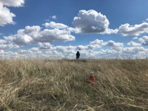
In this field test, STRYDE, Explor, and CMC are demonstrating how STRYDE’s Nodes – the lightest, fastest, and most cost-effective on the market – in combination with Explor’s market-leading PinPoint source can be used to map out and monitor the subsurface for CO2 injection without the need for clearing the area or compromising on data quality. The 1 km2 field test has delivered a new world record of over 256 million traces / km2.
Small team achieves big record
This record was achieved by a field team of only ten people, demonstrating the agility of both the STRYDE Nodes and the PinPoint source system. A single two-person team was consistently able to layout up to 1,000 nodes in a day.
Climate models indicate a critical role for CCUS in climate mitigation efforts. The most recent Sustainable Development Scenario by the International Energy Agency attributes 15% of cumulative emissions reduction to CCUS. However, despite current investment in CCUS and significant projected growth, experts say the rate of development for CCUS projects is still not on track to keep emissions below international targets.
There is also growing stakeholder and investor pressure on the fossil energy industry to drive down emissions. Technologies that reduce the cost of CCUS development and monitoring will help these companies to support new growth in total CCUS capacity and thereby achieve net zero emissions targets.
Monitoring critical to CCUS operations
Subsurface monitoring is critical to the secure operation of any CCUS facility but faces several challenges, including cost and space. As storage projects are usually built near existing infrastructure, subsurface image quality is hampered by the constraints of costly and cumbersome legacy seismic acquisition technology and methods. As a result, many previous CCUS projects have struggled to produce high-quality subsurface imaging due to the wide spacing between seismic nodes and constraints over source positioning.
Mike Popham, CEO of STRYDE, said: “As a business, we are committed to the rapid and collaborative development of exceptional and accessible high-definition seismic solutions. We believe that CCUS has a huge role in enabling the world to tackle global CO2 levels. Put simply, we are making high-density seismic acquisition accessible for CCUS developers, which will help drive the uptake of this crucial technology.”
In this field test, STRYDE’s Nodes and Explor’s source are being trialed against alternative monitoring technologies, such as distributed acoustic sensing (DAS) and other geophone products, with the final dataset to be compared to a previous 3D survey that was undertaken using a conventional seismic layout with a buggy-mounted vibratory source.
Allan Châtenay, President of Explor said: “Our collaboration with STRYDE and CMC is changing the game for subsurface imaging in support of CCUS, and we are proud to have achieved trace density 2.5 times the previous Canadian record. We are delighted with the performance of our next generation PinPoint system, which weighs less than 2 kilograms and can fit in your pocket. The agility and cost-efficiency of this system are driving a step-change in imaging the subsurface and sets a new benchmark for what can be achieved for CCUS.”
Monitoring costs reduced
Don Lawton, Director, Carbon Management Canada said: “The scaling down of the size and cost of seismic technology has opened up so much potential for making both development and ongoing monitoring affordable. The data we can collect from seismic acquisition is incredibly important for continually refining CCUS technology, improving storage efficiency, and reducing risk”
“This record-breaking high density has allowed us to accurately model the very shallow subsurface. In prior tests with 3D seismic imaging with wide line spacing, the data for shallow depths cannot be used – ultimately preventing us from exploring what could be valuable information. The density that we can achieve using STRYDE and Explor really opens up new possibilities for a range of geotechnical purposes.”
STRYDE, CMC, and Explor plan to make data from the demonstration project available under a no-cost license to academic institutions to help drive scientific research and technology development. Datasets will also be available to license for companies who are considering CCUS.
About STRYDE
STRYDE’s mission is to make high-density seismic affordable to any industry.
STRYDE’s customers benefit from a substantially reduced environmental footprint, reduced HSE risk, faster surveys, and significant operational efficiencies. Put simply, STRYDE’s products save customers money and time while enabling them to deliver the best quality seismic data.
STRYDE technology has been used for oil and gas exploration, geothermal, mining, assessing seismic risk, and even for archaeology. This diverse range of operating environments demonstrates the versatility of the STRYDE system, which can scale to meet any end-user requirement on any land terrain.
With over 170,000 STRYDE Nodes deployed or purchased globally, STRYDE is helping customers around the globe to acquire an unparalleled understanding of the subsurface.
To find out more about STRYDE and the game-changing STRYDE Node please visit strydefurther.com or email sales@strydefurther.com
About Explor
Explor is a privately held Canadian company that develops innovative geophysical technologies and methodologies to acquire and deliver high-quality geophysical data with minimal environmental impact.
Explor employs a diverse team of qualified scientists across a range of scientific disciplines as well as project teams and logistics experts to accomplish its objectives through a rigorous and relentless continuous improvement process. Explor specializes in challenging and extraordinary projects.
If you would like more information about this topic, please contact Allan Châtenay at 403-263-5950 or email at explor@explor.net. Explor can also be found at www.explor.net and on LinkedIn, YouTube, Twitter, and Facebook.